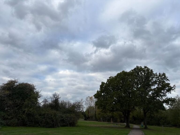
Remaining mostly settled for a while longer, though how much longer is uncertain. Details are a bit tricky, especially so next week.
Thanks to Tara for the photograph.
The general overview sees high pressure centred to the east of Scotland, with low pressure towards Spain – keeping the easterly feed going today/tomorrow, though that will loosen over the weekend.
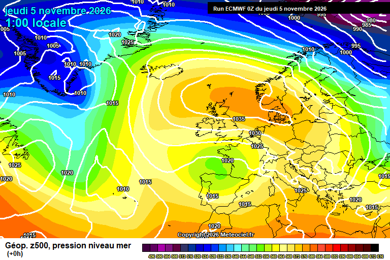
Today will be a mostly cloudy day. Perhaps a bit of brightness at times, more possible later in the day. Feeling cool in the easterly breeze, around 10’C. Mostly cloudy overnight, though some clear spells possible at first, and some patchy rain spreading up from the south-east before dawn. Down to around 6’C.
Friday starts cloudy with some bits and pieces of rain. Staying reasonably cloudy for the rest of the day, though there is a bit more potential for some bright/sunny spells at times – though no guarantee. The odd showery bit of light rain will remain possible also. 11’C, maybe 12’C at a push – the breeze fading. Mostly cloudy overnight – mist/fog may form, especially if the cloud breaks up for even a short period. Down to around 5’C.
Saturday starts with mist/fog/low cloud – and likely this takes quite some time to lift, if it all – more likely it stays cloudy and dull all day, though there is a plausible chnce of some sunny spells in the afternoon. Between 9’C and 11’C, depending on when/if the cloud clears. A chance of a shower later in the day and into the evening also. A mostly cloudy night, mist/fog may well form again – down to around 5’C.
Sunday again starts with mist/fog/low cloud. Again it will take some time to lift – if it does, though a greater chance that it does lift to allow some sunny spells in the afternoon, as the flow turns more southerly. Between 9’C and 12’C, depending on when/if the cloud clears. Some clear spells overnight – a good chance of fog forming after midnight, though not for certain. Down to around 3’C – give or take.
By Monday things get a bit more uncertain – low pressure to our south-west will be trying to push our way.
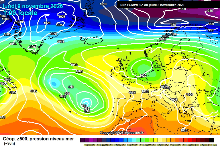
Monday should stay dry, sunshine is more likely than cloud – though uncertain. Reaching around 12’C with the breeze picking up later. Rain may arrive overnight – though possibly it stays further south and we end up foggy.
After that it is a case of working out whether the weather fronts associated with the low pressure to our south-west can progress inland across England – and if so, when.
So a chance of some showery rain on Tuesday, slightly higher chance on Wednesday (say 50/50) – probably some on Thursday, perhaps more persistent. Generally milder too.
That’s the more likely outcome anyway – the less likely outcome is still possible, with said low pressure system staying too far to our south to bring any rain.
After that? Who knows. Maybe drier and colder for a short spell, and more unsettled again for the last third of November? Feels like the slightly more likely outcome, but there is much higher uncertainty than normal. Heck, even this weekend is uncertain enough.
Have a pleasant end to the week.
Any comments?
No comments yet. Be the first to comment!