Everything’s pretty ordinary on the ground for the week ahead, average temperatures, lots of cloud, a bit of sunshine and some rain. Something colder to follow remains a possibility.
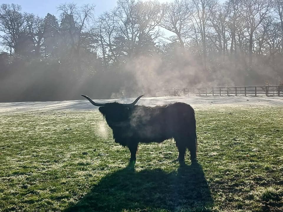
Thanks to Helena, and Gladys for the photograph. Alas, I cannot quite promise this level of sunshine.
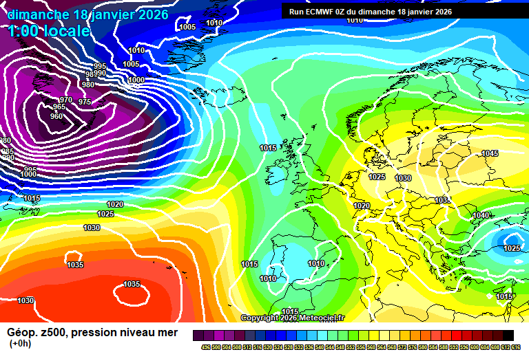
So the general overview sees low pressure systems in the Atlantic not being able to progress that far due to the high pressure block over Europe. We are stuck in the middle.

Low pressure is over Spain/Portugal too, and as low pressure to our west gets closer later in the week, it probably we end up taking a more southerly directly due to the high pressure block.
Today has started cloudy, misty – there’s some bits of rain around too. Generally this is the way it will remain, often cloudy, occasional bits of rain – but there should be some bright/sunny spells at times, more so mid/late morning and early afternoon. Fairly mild, around 10’C. Mostly cloudy overnight, some mist/fog patches possible, perhaps a spot of rain at times – but the weather fronts will remain stuck to our west. Around 7’C.
Monday again will be mostly cloudy, some bits and pieces of mostly light rain though often dry. Some bright/sunny spells at times too. Around 10’C, maybe even 11’C. Similar overnight, often cloudy, occasional splashes of rain, around 7’C.
More hope for some sunshine on Tuesday, there will still be a fair amount of cloud at times, and some showery bits of rain will remain very possible. Around 9’C, maybe 10’C, becoming breezier. Showery rain may develop by late afternoon – some uncertainty on this. Showery rain probable in the evening and overnight, around 6’C.
Details a little sketchy for Wednesday, low pressure will be much closer – overnight weather fronts will probably bring some rain at times on Wednesday, more likely in the morning and evening, perhaps some brightness in between. Feeling a tad cooler, around 8’C and breezy. Rain probable in the evening/overnight.
By Thursday those low pressure systems are queueing up, but cannot make much progress due to the huge high pressure block stretching from Siberia – and edging closer to the UK, with associated very cold air.

So the hemispheric view is really interesting, but down on the ground for us, little difference. Thursday is probably a showery day, lots of cloud, a bit of sunshine – showers probably heavy/very heavy – maybe even a rumble of thunder. Around 9’C, and breezy. Showers possible overnight too.
Into Friday, further rain and/or showers are likely – temperatures roughly around 8’C or so.
Next weekend is fairly uncertain, but the more likely outcome is that the low pressure systems start to give up trying to cross the UK, and sink south – allowing a more easterly (ish) flow to set up.
So showers possible still on Saturday, temperatures a tad colder but nothing unusual.
Sunday more likely on the dry side, but perhaps quite cold by this point.
The more likely outcome for the week after would see colder than normal weather, probably fairly dry though wintry showers possible – overnight frost/fog very possible. Not certain that it will go cold, but the more likely outcome by a fair distance. I’d probably say 70/30 cold vs mild in terms of probabilities.
And there remains the small possibility of something notably cold/snowy.
Have a fun Sunday. Not sure when the next forecast will be as Wednesday is office day and Thursday I’m going to Barcelona for the day and that involves a 7am flight…but I will find the time at some point, as it is quite interesting hemispherically right now…even if it might just seem ordinary on the ground here.
Any comments?
No comments yet. Be the first to comment!